

Creag an Lochain [A'Chaoirnichain]
Good walks are even better shared.
Overview
Creag an Lochain [A'Chaoirnichain]
Creag an Lochain, reaching an elevation of 706 meters, is a charming Corbett located in the stunning Scottish Highlands. Often overshadowed by its higher neighbours, it offers a perfect blend of scenic beauty and gentle challenge for the enthusiastic hiker.
Geology
The mountain is primarily composed of metamorphic rocks, namely schist and gneiss, which tell tales of ancient geological processes. As you make your ascent, look for intriguing rock formations and the dramatic textures left by the elements throughout the ages.
Routes
The most popular route is the A'Chaoirnichain Circuit. This moderate loop begins at Strathcarron and spans approximately 12.5 km, taking around four hours to complete. The trail offers scenic views and a chance to savour the Highland air. Just remember, a good pair of boots is worth their weight in gold here!
Summit Features
Upon reaching the summit, you'll be greeted by a prominent stone cairn. It’s an ideal spot for a photo op or even a quick snack—just watch out for those sneaky birds ready to share your sandwiches!
Terrain Type
Expect a delightful mix of grassy slopes, well-defined paths, and a few rocky outcrops. Be mindful of the boggy areas that can surprise you, particularly in the damp months. Waterproof boots are recommended!
Views
The views from Creag an Lochain are nothing short of spectacular. To the southwest, the rugged peaks of the Cuillin in Skye loom majestically, while the Torridon range graces the horizon. Late spring and early autumn offer the best visibility, minus the pesky midges.
Hazards
Be aware of the swiftly changing weather and prepare accordingly. Loose stones and boggy patches can present challenges, especially during wet conditions. It's advisable to check the forecast before heading out.
Nearby Summits
For the ambitious, nearby peaks like Beinn Dronaig and Sgurr na Ciche provide excellent opportunities for further exploration. Each summit has its unique charm and challenges.
Access
Parking is conveniently located at the Strathcarron Hotel, which is also a great starting point for your adventure. Limited public transport services run to Strathcarron, so plan your journey wisely. The village itself has basic amenities for your convenience.
Facilities
The local café is a quaint stop for refreshments—perfect for a pre-hike caffeine boost or post-hike treat. And remember, public toilets are available, so no need to go bush!
History
The name Creag an Lochain reveals its rich heritage, meaning 'the crag of the little loch'. It's a humbling reminder of the land's history, once trodden by clans and adventurers alike.
With each step on Creag an Lochain, you’re not just hiking; you’re walking in the footsteps of history. So lace up your boots, pack your sense of adventure, and take to the trails of this hidden gem in the Highlands!
Happy hiking!
Explore routes near Creag an Lochain [A'Chaoirnichain]
Public walks starting within 80 km of this hill. Nearby does not mean a route reaches the summit; check its map and access before setting out.
Ben Klibreck
View route
Loch Migdale from Torroy: Spinningdale pinewood and loch shore walk
View route
Findhorn guided night walk
View route
Culbin Forest: Hill 99, Gravel Pit Ponds and Dragonfly Pool
View route
Route planning notes
These notes describe possible approaches, not verified navigable routes or permission to cross land. Check current paths, local access rules and conditions before setting out.
A'Chaoirnichain Circuit
A scenic loop starting from the village of Strathcarron that provides a rewarding ascent with impressive views.
Make a day of it, together
Find someone to share the walk with, or organise a day out along a route you like.
Photo Gallery
View all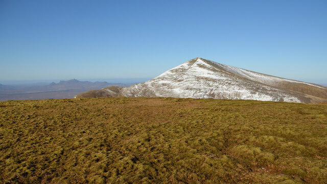 Photo could not load
NC5728 : On Creag an Lochain, Ben Klibreck, Sutherland
Andrew Tryon
Hill facts and local notes
Classifications
Elevation
807m
2,649 ft
Prominence
119m
Coordinates
58.2180, -4.4261
NC575280
OS Map
16
Explorer: 443
At the Summit
The summit features a large stone cairn and offers panoramic views of the surrounding mountains and lochs, making it a perfect spot for a summit sandwich.
Terrain & Geology
Primarily composed of metamorphic rock, featuring schist and gneiss typical of the Scottish Highlands. The area's rugged geological history can be appreciated through the weathered crags and varied rock formations.
Views & Scenery
From the summit, you'll enjoy views of the impressive surrounding peaks including the Cuillin on Skye and the distant peaks of the Torridon range.
History & Heritage
Name Origin
Creag an Lochain translates to 'the crag of the little loch', reflecting the mountain's geography and its picturesque surroundings.
Historical Significance
The area is rich in Scottish heritage, with ancient connections to the clans that roamed these hills. It's a great place to reflect on the land's storied past.
Getting There & Facilities
Check current local access restrictions, parking rules and transport timetables before travelling. These notes do not confirm public access to the summit.
Parking
Parking is available at the Strathcarron Hotel, a convenient spot to gear up before your hike.
Public Transport
The nearest train station is Strathcarron, with limited services. It is advisable to check the schedule ahead of time.
Nearby Facilities
A small café in Strathcarron provides refreshments, as well as public toilets (though you might want to take a break before venturing out).
Safety Information
Known Hazards
- Variable weather conditions can change rapidly, so be prepared for anything Mother Nature throws your way. Loose stones and tricky bogs can be present especially in wet conditions.
General Safety Tips
- Check weather conditions before setting out
- Carry appropriate clothing and equipment
- Let someone know your planned route
- Take a map, compass, and GPS device
- Carry emergency supplies: food, water, first aid kit, torch
Hills
Some common questions about the hills answered
Are there group walks up Creag an Lochain [A'Chaoirnichain]?
Many walkers use Walkmates to join or organise walks with others. You can check for group walks around Creag an Lochain [A'Chaoirnichain] through the maps
Are there other walkers around Creag an Lochain [A'Chaoirnichain]?
Activity varies by location and time, but Walkmates lets you see whether others have shared walks or shown interest in this area. Find other people through the walking friends search walking friends for Creag an Lochain [A'Chaoirnichain] search or of course create your own walk for Creag an Lochain [A'Chaoirnichain]
Can I organise a walk to Creag an Lochain [A'Chaoirnichain]?
Yes. If there aren’t any walks listed already, you can create a walk and make it available for others to join.
If you're signed up to Walkmates, you can create a walk to Creag an Lochain [A'Chaoirnichain].
How do I find a walk up this hill?
There are often multiple ways to walk this hill, depending on experience and route preference. Walkmates helps you explore walks and routes that others have shared.
Can I suggest a new route up Creag an Lochain [A'Chaoirnichain]?
Yes. You can suggest or create routes to share with others. Walkmates focuses on the social side of walking, so routes are used to help people organise walks and explore areas together, rather than as detailed navigation tools or route libraries.
Other uses really appreciate knowledgeable walkers sharing their routes. Share your favourite route to Creag an Lochain [A'Chaoirnichain] here
The is an error or something incorrect about this hill. How do I let you know?
We always strive to keep the information on Walkmates as accurate as possible. If you find an error, please let us know through the contact form and we'll aim to correct it as quickly as possible
Community Discussion
Comments
Location
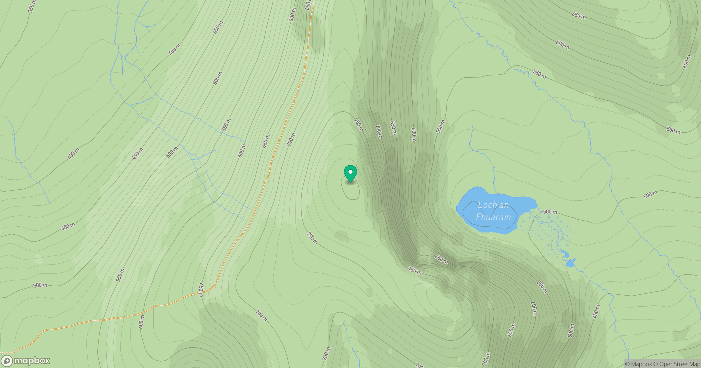
Grid reference: NC575280
View on OpenStreetMapOpens a map in a new tab, centred on the hill.
Hills within 30 km
Straight-line distance, not a walking route or confirmation of access.
Ben Loyal - An Caisteal
764m
Ben Hope
927m
Ben More Assynt
999m
Ben Klibreck - Meall nan Con
962m
Meall a' Bhata
583m
No comments yet. Be the first.